(PNA photo by Robert Oswald L. Alfiler)
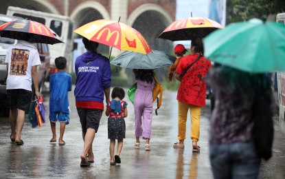
MANILA – There is no tropical cyclone monitored outside the Philippine Area of Responsibility (PAR) while the southwest monsoon (habagat) continues to affect some parts of the country, according to the Philippine Atmospheric, Geophysical and Astronomical Services Administration (PAGASA) on Sunday.
The whole Visayas and northern portion of Palawan will have cloudy skies with scattered rain showers and thunderstorms while the rest of Palawan including Kalayaan Islands and Occidental Mindoro will have partly cloudy to cloudy skies with isolated rain showers or thunderstorms.
Metro Manila and the rest of Luzon will have partly cloudy to cloudy skies with isolated rain showers or thunderstorms.
Moderate to strong winds from southwest will prevail over Palawan, including Kalayaan Islands, and Occidental Mindoro with moderate to rough seas. Light to moderate winds from southwest will prevail over Visayas with slight to moderate seas.
Sunset is at 6:20 p.m.
On Saturday, PAGASA recorded “extreme danger” heat index level, or at least 52 degrees Celsius, in Baler, Aurora (53 degrees).
In contrast, Baguio City’s temperature at 8 a.m. Sunday was 17.2 degrees Celsius.
For August, PAGASA expects two or three tropical cyclones that may enter or develop inside the PAR.
Rainfall forecast for the month shows that generally near normal condition is expected in most parts of the country, with some areas in the western part of Luzon likely to receive above normal rainfall. (PNA)
