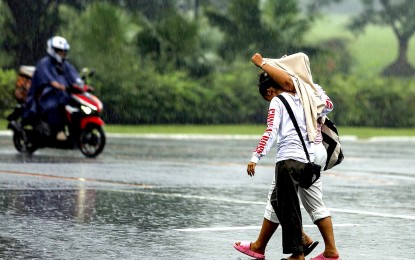
TAKE COVER. A couple shares a single jacket being caught unprepared by the sudden downpour at the University of the Philippines Diliman in Quezon City on Sunday afternoon (Sept. 17, 2023). Most parts of the country will experience rain showers due to the southwest monsoon (habagat) and localized thunderstorms, the weather bureau said Tuesday (Sept. 26, 2023). (PNA photo by Joan Bondoc)
MANILA – Most parts of the country will experience rain showers due to the southwest monsoon or "habagat" and localized thunderstorms, the weather bureau said Tuesday.
"The southwest monsoon will cause high chances of rains over Mimaropa and Western Visayas. Take precautions against possible flash floods or landslides," Grace Castañeda of the Philippine Atmospheric, Geophysical and Astronomical Services Administration (PAGASA) said.
High chances of rains due to localized thunderstorms, especially in the afternoon or evening, is also forecast over Metro Manila and the rest of the country.
"Light to moderate rains may be experienced as early as noon," Castañeda said, adding that flash floods or landslides are also possible.
Temperature in Tuguegarao could reach up to 35 °C; up to 32 °C in Metro Manila, Legazpi, Kalayaan Islands, Puerto Princesa and Laoag.
Zamboanga's temperature could reach 34 °C; while up to 33 °C temperature is expected in Tacloban, Cagayan de Oro and Davao.
Light to moderate winds and slight to moderate seas will continue to prevail across the archipelago.
Meanwhile, Castañeda said the low pressure area (LPA) outside the Philippine Area of Responsibility (PAR) has a slim chance of developing into a tropical cyclone.
"We don't discount the possibility that the LPA would enter PAR in the next days," she said. (PNA)
