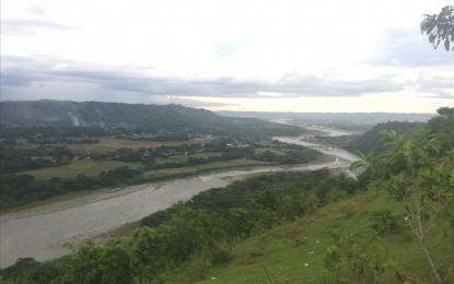
IRRIGATION. The Chico River, as seen from Tabuk City, Kalinga, is one of the major river systems in the Cordillera that has been desilted by the Department of Public Works and Highways to allow water to flow freely, especially with huge volume expected during the rainy season. The government continues to increase the areas covered by irrigation facilities aside from maintaining and restoring existing ones to ensure adequate water supply for farmlands. (PNA photo by Liza T. Agoot)
BAGUIO CITY – The National Irrigation Administration (NIA) said at least 61.2 percent of potential irrigable areas in the Cordillera Administrative Region (CAR) have been soaked, allowing farmers to till the land for the whole year.
“Every year, the region gets a budget for additional irrigation systems aside from funds for the rehabilitation and revival of old, existing and damaged irrigation systems,” Benito Espique, NIA-CAR Manager, said in a phone interview on Friday.
NIA data showed there are 185,406 hectares (ha) of potential irrigable areas in the six provinces of the region - - 25,670 ha in Abra; 33,910 ha in Apayao; 25,746 ha in Benguet; 25,830 ha in Ifugao; 44,190 ha in Kalinga; and 30,060 ha in Mountain Province.
“The developed areas have reached 113,539.32 ha, with Abra having the most irrigated areas at 80.83 percent,” the executive said.
Abra has 20,748 ha of irrigated areas having completed 80.83 percent; Apayao, 12,568.76 ha or 37.07 percent; Benguet, 16,442.31 ha or 63.86 percent; Ifugao has 20,469.24 ha or 79,25 percent; Kalinga with 30,486.91 ha or 68.99 percent; and Mountain Province 12;823.17 ha or 42.66 percent.
The Department of Agriculture, in a separate report, said Cordillera has total agricultural land of 200,685 ha being tilled by 206,200 farmers, who are managing an average farm size of 7,400 square meters.
About 86,896 ha of the region’s agricultural land are used for rice production; 57,417 ha for corn; 56,009 ha for high-value crops; and 19,502 ha for the production of organic agricultural products.
Cordillera produces 331,470 metric tons (MT) of rice; 156,463 MT of yellow corn; 15,308 MT of white corn; 226,157 MT of nine priority commodities of highland vegetables; 1,886.17 MT of coffee; and 54,441 MT of heirloom rice.
La Niña preps
Espique said desilting, declogging and repair activities were undertaken when El Niño hit to prepare the irrigation system once the rainy season starts, especially with La Niña expected from September 2024 to January 2025.
“Inspection and maintenance of intake gates and sluice gates have also been done to ensure proper functioning,” he said.
He said NIA-CAR also conducted vulnerability assessment and mapping to identify areas susceptible to flooding.
“We conduct systems management committee meetings on La Niña with stakeholders, including the local government units, to discuss actions to be undertaken, monitoring of damage and reporting of losses,” he added. (PNA)
