(PNA photo by Joan Bondoc)
MANILA – Tropical Storm Carina maintained its strength as it decelerates over the Philippine Sea, according to the 5 p.m. bulletin Sunday of the Philippine Atmospheric, Geophysical and Astronomical Services Administration (PAGASA).
As of 4 p.m., Carina was estimated based on all available data 365 km east northeast of Casiguran, Aurora. It was almost stationary.
It packs maximum sustained winds of 85 km per hour (kph) near the center and gustiness of up to 115 kph.
No Tropical Cyclone Wind Signal has been hoisted but Signal No. 1 is likely over extreme northern Luzon and the northeastern portion of mainland Cagayan, possibly later Sunday or Monday.
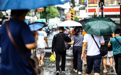
Metro Manila has a 100 percent chance of rain on Monday and Tuesday, according to the PAGASA forecast.
Rains are likewise expected until Monday afternoon in the eastern portion of Cagayan and Babuyan Islands; and rest of mainland Cagayan and northeastern portion of Isabela.
Rains will continue Tuesday in Batanes, eastern portion of Cagayan, Babuyan Islands, rest of mainland Cagayan and the northeastern portion of Isabela.
PAGASA also said that the enhanced southwest monsoon (habagat) will bring moderate to intense rainfall over various localities in the western portion of Luzon through Tuesday. (PNA)
