(File photo)
MANILA – Severe Tropical Storm (STS) Carina has intensified, now packing maximum sustained winds of 110 kph near the center, and gustiness of up to 135 kph, the weather bureau said Monday.
In its 11 a.m. bulletin, the Philippine Atmospheric, Geophysical and Astronomical Services Administration (PAGASA) said Carina was last tracked 355 km. east of Tuguegarao City, Cagayan, moving northwestward at 15 kph.
Batanes was placed under tropical cyclone warning Signal No. 1.
The eastern portion of mainland Cagayan (Santa Ana, Gattaran, Baggao, Peñablanca, Lal-Lo, Gonzaga) including the eastern portion of Babuyan Islands (Camiguin Is., Babuyan Island), and the northeastern portion of Isabela (Divilacan, Palanan, Maconacon) remain under Signal No. 1.
Those areas could experience minimal to minor impacts due to strong winds, PAGASA said.
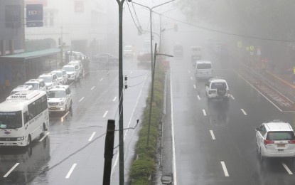
Carina enhances the southwest monsoon, which is forecast to bring moderate to intense rainfall over various localities in the western portion of Luzon on Monday night until Wednesday.
The southwest monsoon will also bring strong to gale-force winds in Zambales, Bataan, Aurora, Mimaropa, Bicol Region, Western Visayas, Northern Samar, and the northern portion of Samar.
Carina and the southwest monsoon continue to cause moderate to rough seas over the northern and eastern seaboards of Northern Luzon.
Mariners of small seacraft, including all types of motorbancas, are advised not to venture into the sea.
Moderate seas continue to prevail over the seaboards of Central and Southern Luzon and the eastern seaboards of the Visayas and Mindanao.
Mariners of motorbancas and similarly-sized vessels were advised to take precautionary measures while venturing out to sea and, if possible, avoid navigating under these conditions. (PNA)
In its 11 a.m. bulletin, the Philippine Atmospheric, Geophysical and Astronomical Services Administration (PAGASA) said Carina was last tracked 355 km. east of Tuguegarao City, Cagayan, moving northwestward at 15 kph.
Batanes was placed under tropical cyclone warning Signal No. 1.
The eastern portion of mainland Cagayan (Santa Ana, Gattaran, Baggao, Peñablanca, Lal-Lo, Gonzaga) including the eastern portion of Babuyan Islands (Camiguin Is., Babuyan Island), and the northeastern portion of Isabela (Divilacan, Palanan, Maconacon) remain under Signal No. 1.
Those areas could experience minimal to minor impacts due to strong winds, PAGASA said.
Carina enhances the southwest monsoon, which is forecast to bring moderate to intense rainfall over various localities in the western portion of Luzon on Monday night until Wednesday.
The southwest monsoon will also bring strong to gale-force winds in Zambales, Bataan, Aurora, Mimaropa, Bicol Region, Western Visayas, Northern Samar, and the northern portion of Samar.
Carina and the southwest monsoon continue to cause moderate to rough seas over the northern and eastern seaboards of Northern Luzon.
Mariners of small seacraft, including all types of motorbancas, are advised not to venture into the sea.
Moderate seas continue to prevail over the seaboards of Central and Southern Luzon and the eastern seaboards of the Visayas and Mindanao.
Mariners of motorbancas and similarly-sized vessels were advised to take precautionary measures while venturing out to sea and, if possible, avoid navigating under these conditions. (PNA)
