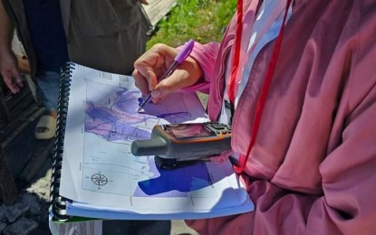
GEOHAZARD ASSESSMENT. Vulnerability and risk assessment conducted in Bacolod City in April this year. From 2023 until this year, 12 other local government units in Negros Occidental are also part of the geological assessment for risk reduction and resiliency conducted by the Department of Environment and Natural Resources-Mines and Geosciences Bureau-Western Visayas. (File photo of Bacolod City DRRMO)
BACOLOD CITY – Thirteen local government units (LGUs) in Negros Occidental, including this highly urbanized city, are undergoing geological assessment for risk reduction and resiliency being conducted by the Department of Environment and Natural Resources-Mines and Geosciences Bureau-Western Visayas (DENR-MGB Region 6).
These include land geohazard assessment, coastal geohazard assessment, and groundwater resource mapping and assessment under the National Geohazard Assessment and Mapping Program.
MGB-6 data, as of Monday, showed that Bacolod City was assessed for the land geohazard during the first half of 2024, while Pontevedra town followed for the remaining second half.
In 2023, Don Salvador Benedicto also underwent a similar assessment.
“Upon completion of the 1:10,000 scale geohazard assessment, updating of maps have been ongoing, simultaneously conducted with the vulnerability and risk assessment,” the MGB-6 said in a statement, adding that the assessment is up for completion within the next few years.
The output of the activity, the geohazard maps, will be provided to the LGUs after a thorough information, education and communication campaign and will also be available on the MGB-6 official website.
“Technical information provided by these geohazard maps have been used by LGUs in the updating and modification of their comprehensive land use programs as well as in project development, disaster preparedness, management and mitigation programs,” it added.
The cities of Sipalay and Kabankalan were assessed for coastal geohazard in the first half of this year, along with the municipalities of Hinoba-an and Ilog, while the assessment for Pulupandan town was done last year.
The cities of Sagay and San Carlos, as well as Calatrava town, are set for assessment by the second half of 2024.
“The detailed coastal geohazard assessment and mapping emphasizes the various hazards present along the coastal areas of the country such as erosion, accretion, and subsidence. This program aims to provide information and give appropriate recommendations relative to the sea level rise because of global warming,” the MGB-6 said.
Meanwhile, the groundwater resource mapping and assessment aims to assess the groundwater resource potential of a certain area and aids in providing information to LGUs to identify areas for groundwater resource development for public consumption.
The cities of Bacolod, Talisay, and Silay were assessed in the first half of 2024 during the dry season and in the second half for the wet season phase.
“The first phase includes the well data survey done during the dry and wet seasons while the second component is the geophysical study through the conduct of geo resistivity surveys,” it added. (PNA)
