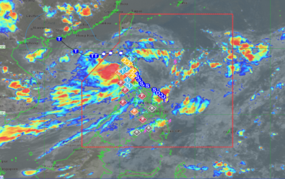
PAGASA/DOST Satellite image
MANILA – Tropical Storm Enteng is now in the vicinity of Maddela, Quirino, after making landfall in Casiguran, Aurora, the weather bureau said Monday.
In its 5 p.m. update, the bureau said Enteng packs maximum sustained winds of 85 kph near the center, and gustiness of up to 140 kph.
Gale-force winds will be experienced in areas where tropical cyclone wind signal (TCWS) No. 2 was hoisted: Ilocos Norte, Apayao, the eastern portion of Kalinga (Rizal, Pinukpuk, City of Tabuk), Cagayan including Babuyan Islands, Isabela, Quirino, and the northern portion of Aurora (Casiguran, Dilasag, Dinalungan, Dipaculao, Baler).
Strong winds, on the other hand, will prevail in areas under TCWS No.1: Batanes, Ilocos Sur, La Union, the eastern portion of Pangasinan (Rosales, Asingan, Binalonan, Sison, San Manuel, Santa Maria, Balungao, San Quintin, Tayug, Umingan, Natividad, San Nicolas), Abra, the rest of Kalinga, Mountain Province, Ifugao, Benguet, Nueva Vizcaya, the rest of Aurora, Nueva Ecija, the eastern portion of Bulacan (Doña Remedios Trinidad, Norzagaray, City of San Jose del Monte, Obando, City of Meycauayan, Bocaue, Balagtas, Bustos, Baliuag, Pandi, Santa Maria, Marilao, Angat, San Rafael, San Ildefonso, San Miguel), Metro Manila, Rizal, the northeastern portion of Laguna (Santa Maria, Mabitac, Pakil, Pangil, Famy, Siniloan), and the northern portion of Quezon (General Nakar, Infanta, Real) including Polillo Islands.
The Philippine Atmospheric, Geophysical and Astronomical Services Administration (PAGASA) said the enhanced southwest monsoon will continue bring heavy rains in the following areas: Ilocos Region, Nueva Vizcaya, Quirino, Isabela, Apayao, Abra, Benguet, the northern and central portions of Aurora, Zambales, Bataan, Nueva Ecija, Bulacan, Rizal, Metro Manila, and the rest of Cagayan Valley, and Cordillera Administrative Region.
For the next three days, other areas in Luzon and the Visayas are also forecast to experience heavy to intense rains due to the enhanced southwest monsoon, PAGASA said.
Meanwhile, minimal to moderate risk of storm surge may occur in the next 48 hours in the low-lying or exposed coastal localities of Batanes, Cagayan, Isabela, Ilocos Norte, Ilocos Sur, and Aurora.
Gale Warning is in effect over the northern and eastern seaboards of Luzon. Sea travel is risky for small seacraft, including all types of motorbancas.
Moderate to rough seas are forecast over the western seaboard of Northern and Central Luzon, the western, eastern and southern seaboards of Southern Luzon outside Gale Warning areas, and western seaboard of the Visayas.
Mariners of small seacraft, including all types of motorbancas, are advised not to venture out to sea under these conditions, especially if inexperienced or operating ill-equipped vessels.
Slight to moderate seas is expected over the eastern seaboards of Visayas and Mindanao.
PAGASA advised mariners of motorbancas and similarly-sized vessels to take precautionary measures while venturing out to sea and, if possible, avoid navigation under these conditions. (PNA)
