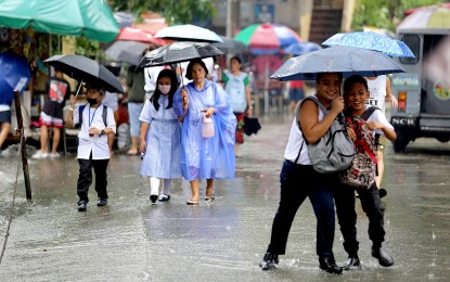
UNDER ONE UMBRELLA. Two classmates having fun on their way home from Marcelo H. Del Pilar Elementary School in Quezon City despite the inconvenience of a sudden downpour on Sept. 12, 2023. The low pressure area last tracked 1,400 kilometers east of northeastern Mindanao would likely develop into a tropical cyclone within the day or Tuesday, the weather bureau said Monday (Nov. 13, 2023). (PNA photo by Joan Bondoc)
MANILA – The low pressure area (LPA) last tracked 1,400 kilometers east of northeastern Mindanao would likely develop into a tropical cyclone within the day or Tuesday, the weather bureau said Monday.
It is also likely to enter the Philippine Area of Responsibility (PAR) by Wednesday, said Obet Badrina of the Philippine Atmospheric, Geophysical and Astronomical Services Administration (PAGASA).
"This could still change," he said, adding that PAGASA has yet to determine the possible cyclone's track since it is still outside PAR.
Meanwhile, Badrina said two weather systems, the shear line and the northeast monsoon or "amihan" will bring rain showers over parts of the country.
The shear line will bring scattered rain showers and thunderstorms over Bicol Region, Aurora, Quezon, and Northern Samar. Moderate to heavy rains in these areas may cause flash floods or landslides.
The northeast monsoon, on the other hand, will cause rains over Cagayan Valley and Apayao, and isolated light rains over the Ilocos Region, the rest of Central Luzon, and the rest of the Cordillera Administrative Region.
Isolated rain showers due to localized thunderstorms may be experienced over the rest of the country.
Moderate to strong winds and moderate to rough seas prevail over Northern Luzon.
Elsewhere, winds will be light to moderate with slight to moderate seas, PAGASA said. (PNA)
