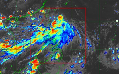
(Screen grabbed from PAGASA Facebook page)
MANILA – The low pressure area spotted in east of extreme Northern Luzon has developed into a tropical depression, according to the Philippine Atmospheric, Geophysical and Astronomical Services Administration (PAGASA).
The weather bureau called the new weather disturbance Tropical Depression Igme.
In its latest bulletin issued at 5 p.m. Friday, the weather bureau said that at about 4 p.m. Igme was estimated at 530 km East Northeast of Itbayat, Batanes, and is moving Northwestward at 15 km per hour.
It is packed with maximum sustained winds of 55 kph near the center, and gustiness of up to 70 kph, with strong winds that extend outwards up to 720 km from the center.
Tropical Cyclone Wind Signal (TCWS) number 1 is hoisted over Batanes.
The weather bureau also said that Igme will enhance the southwest monsoon or “habagat” and will continue to affect many parts of Luzon.
It will bring strong to gale-force gusts over the areas of Ilocos Region, Batanes, Babuyan Islands, Zambales, and Bataan on Friday and in the Ilocos Region, Batanes, Babuyan Islands, Zambales, and Bataan on Saturday.
Meanwhile, moderate to rough seas will be experienced at the seaboards of Northern and Central Luzon, and the western seaboard of Southern Luzon.
‘Igme’ is forecast to move generally west-northwestward until the morning of Sunday (Sept. 22).
It is expected to exit the Philippine Area of Responsibility by Sunday. (PNA)
