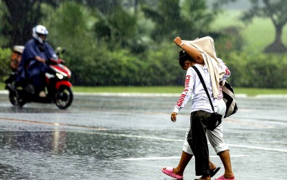
(PNA photo by Joan Bondoc)
MANILA – Carina has become a severe tropical storm (STS) while remaining almost stationary, according to the 10 p.m. weather bulletin Sunday.
Tropical Cyclone Wind Signal No. 1 has been raised in Sta. Ana, Cagayan.
The center of STS Carina was estimated based on all available data at 385 kilometers east of Casiguran, Aurora as of the latest advisory of the Philippine Atmospheric, Geophysical and Astronomical Services Administration (PAGASA).
On Monday, the southwest monsoon (habagat) enhanced by Carina will bring moderate to heavy rains over La Union, Pangasinan, Benguet, Zambales, Bataan and Occidental Mindoro; while moderate to occasionally heavy rains are likely over Metro Manila, Ilocos Norte, Ilocos Sur, Abra, Tarlac, Pampanga, Bulacan, Nueva Ecija, Rizal, Cavite, Batangas, and Calamian Islands.
PAGASA forecast heavy to intense rains Tuesday over Ilocos Region, Benguet, Zambales, Bataan, and Occidental Mindoro; and moderate to heavy rains over Metro Manila, Apayao, Abra, Tarlac, Pampanga, Bulacan, Nueva Ecija, Rizal, Cavite, Laguna, Batangas and Calamian Islands. (PNA)
